- Software - Simulation >
- Software >
- Analysis software >
- Environmental Systems Research Institute
Environmental Systems Research Institute analysis software
{{product.productLabel}} {{product.model}}
{{#if product.featureValues}}{{product.productPrice.formattedPrice}} {{#if product.productPrice.priceType === "PRICE_RANGE" }} - {{product.productPrice.formattedPriceMax}} {{/if}}
{{#each product.specData:i}}
{{name}}: {{value}}
{{#i!=(product.specData.length-1)}}
{{/end}}
{{/each}}
{{{product.idpText}}}
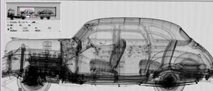
... intuitive GUI (no more than 2-mouse clicks to perform image analysis) • Increased operator efficiency due to a range of customisable tools • A full set of operator roles; check-in, image analysis, recheck, ...
SMITHS DETECTION

Imaging software that provides organic/inorganic material discrimination, and colour differentiation between inspected objects. viZual imaging software helps to distinguish unexpected loads by adding ...
SMITHS DETECTION

... improved operations by delivering critical insights and enabling remote screening. Checkpoint.Evoplus’ intelligence software analyses data from various systems, sensors and components from across an entire screening ...
SMITHS DETECTION
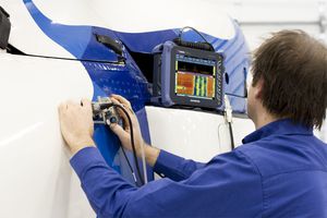
Setup, Inspection, and Analysis Software Solutions Compatible with OmniScan SX flaw detector data, these software solutions assist you with setup configuration, automated data analysis, ...
Evident - Olympus Scientific Solutions
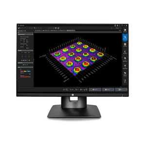
... compatibility enables efficiency. PRECiV™ software is scalable and offers dedicated packages for conventional and digital microscopes. Different departments in your company can purchase a license for the level of ...
Evident - Olympus Scientific Solutions
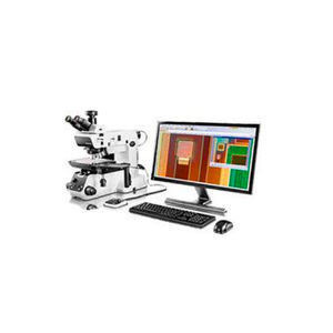
... The software enables you to make a variety of geometric measurements interactively or with advanced image processing and analysis capabilities. Standard compliant measurements can also be produced using ...
Evident - Olympus Scientific Solutions

The Thales Cogent ACE-V Manager software provides an intuitive, logical system that organizes by case and records notes, evidence, and annotations. With advanced enhancement capabilities built into the program and ...
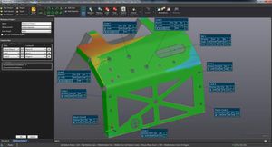
... dimensional inspection software that enables quality control and quality assurance professionals to perform inspections and generate reports based on meticulous engineering requirements. Whether for performing simple ...

... testing. USTOM INTERFACING VXtrack is a customizable, easy-to-use dynamic control software that requires little training. Moreover, the interface of the 3D tracking software can be fully adapted to ...
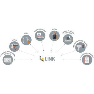
Integrate GapGun and Vectro measurement tools into your existing production systems using Link 01 INTEGRATION WITH A MEASUREMENT DATABASE Measurement requirements including tools, nominals and tolerances, and measurement results ...
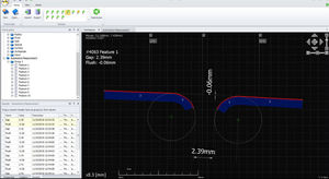
... CHECKPLANS, PROVIDING INTERACTIVE ANALYSIS OF RESULTS, DATA LOGGING, AND INTERFACING TO THIRD PARTY SPC SOFTWARE. High performance processing: Multi core processing enables super fast measurements ...
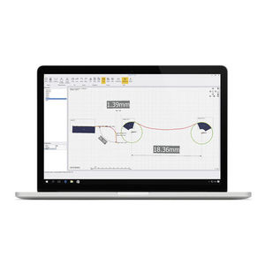
ULTRA-FLEXIBLE QUALITY INSPECTION SOFTWARE THE ULTIMATE ANALYSIS TOOL Inspect is the ideal tool for replacing old contracer and shadowgraph techniques. Use Inspect with GapGun or Vectro laser ...

Airport operational database (AODB) is the “heart” of airport operations management. The Airport Operational Database integrates airport control systems, airport resource allocation, and airport invoicing systems. It works as a central ...

... to equip airport staff and airport stakeholders with updated information for their efforts in coordination, reporting, and analysis Benefits of Airport Operation Control Center (AOCC) Solution The AOCC systems ...
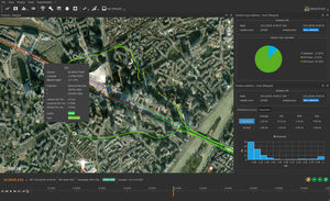
Your Full-featured INS/GNSS Post-processing Solution Want to improve your navigation data, to access further analysis, to fix some outages in your trajectory? Qinertia PRO gives access to post-processing to all ...

... the SBG Ellipse miniature inertial sensors. Whether your survey is UAV or Car based, Qinertia improves trajectory and data analysis. All Ellipse sensors Land and air applications All processing: INS/GNSS and GNSS ...


data collection softwareHappyOrNot Analytics
... data insights HappyOrNot delivers actionable data that empowers you to make informed decisions. Our proprietary analytics software provides detailed reports, visualizations, and trends, helping you instantly understand ...
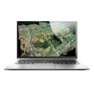
The leading photogrammetry software for professional drone mapping Capture Capture RGB, thermal, or multispectral images with any camera. Any camera. Any drone. Any imagery. As long as it’s a .jpg or a .tif. Digitize Pix4Dmapper’s ...

Agilent MicroLab Mobile software uses the same framework as the PC version of the software, but on a mobile platform, allowing users to select a variety of methods with the click of a button. With MicroLab ...
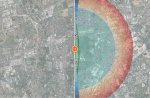
... Geographic Information System) software, also working in Open-Source, that allows the management of existing obstacles, in addition to the possibility to identify new ones by means of three-dimensional analysis ...

... Enhanced passenger service with a seamless travel experience and reductions in lost and mishandled bags - Instant Access – software can be accessed via Internet using secure HTTPS and/or intranet OPERATIONAL BENEFITS - ...
Zafire Aviation Software Ltd

The most comprehensive Aviation service management solution available FirstRamp is the most comprehensive cloud based aircraft turnaround planning, servicing, resource and fleet optimisation and business intelligence reporting application ...
Zafire Aviation Software Ltd

FirstLoad is a tablet application designed to mobilise traditional weight and balance software and empower airside operations with the latest information available. FirstLoad is a truly global mobilised solution which ...
Zafire Aviation Software Ltd

Imagery hosting, streaming, and analysis in the cloud ArcGIS Image for ArcGIS Online is a complete software as a service (SaaS) offering for hosting, analyzing, and streaming imagery and raster collections. ...
ENVIRONMENTAL SYSTEMS RESEARCH INSTITUTE, INC.
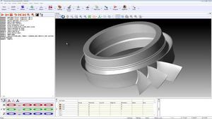
Nominal section generation For each section that is to be evaluated, it is necessary to create a nominal curve from the CAD model. MODUS provides this capability for any number of sections with the 'Add Slice' function. MPCS is used ...
Renishaw PLC
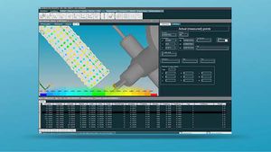
... Compatible with Hexagon Coordinate Measurement Machines. Additional support available for 3rd party devices via I++DME Server Analysis of standard and advanced geometries Comprehensive CAD functionalities Reverse engineering ...
HEXAGON METROLOGY SAS

Why choose CAE’s Operations Control? Deliver elevated customer & employee experience Improve operational efficiency & performance Reduce costs & increase profitability The right solution for airline operators Access key ...
CAE

... through their country. This solution simplifies information retrieval by improving data quality for a more enhanced data analysis. A single interface of all information for governments and carriers SITA API PNR Gateway ...

... creation directly from a secure cloud network, the 3DEXPERIENCE® platform. Global brands leverage 3DEXCITE for services and software to evolve their marketing beyond messaging. 3DEXCITE helps them to create marketing ...
DASSAULT SYSTEMES

Cargospot Airline is airfreight’s most widely used and comprehensive cargo management system, providing carriers with complete end-to-end control over the sale, operation and management of cargo. Flexible schedule & capacity management Comprehensive ...
CHAMP Cargosystems (UK) Ltd

... revenues for each future turnaround cycle. Get accurate data for analysis of airport operations Ensure the accuracy of your data, monitor movements in real-time, and benefit from live analysis of ...
Amadeus IT Group SA

Vaisala Insight PC Software gives quick access to the configurations and data of the Indigo family measurement probes and other supported Vaisala devices. The probes can be detached from the process and connected to a ...
VAISALA OYJ
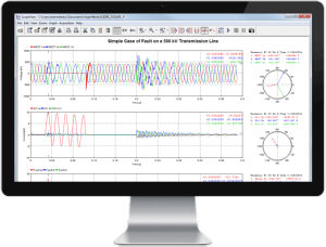
... formats (MATLAB, CSV, COMTRADE, etc.). Refined Results, Precise Analysis ScopeView features enable performance of advanced signal processing, mathematical calculations and analysis. ScopeView interacts ...
OPAL-RT Technologies

Visualize, localize, and document your inspections with Inspector 4.0. An easy-to-use software solution developed to allow asset operators to make fast, data-driven decisions. Without the right management solution, ...
FLYABILITY

... for data analysis and evaluation of surveillance system performance against conformity of EUROCAE specification. This information system can be used for continuous sensor performance validation, real coverage analysis ...
ERA A.S.
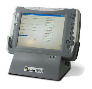
... Avionica developed the RSU-II after seven years’ experience fielding the original RSU and AVSCAN, our acclaimed flight data analysis software. Size/Weight Length: 27.0cm (10.6”) Width: 18.4cm (7.2”) Depth: ...
Your suggestions for improvement:
Receive updates on this section every two weeks.
Please refer to our Privacy Policy for details on how AeroExpo processes your personal data.
- Brand list
- Manufacturer account
- Buyer account
- Our services
- Newsletter subscription
- About VirtualExpo Group


Please specify:
Help us improve:
remaining