
- Products
- Catalogs
- News & Trends
- Exhibitions
Professional UAV UX-SPYROmappingagriculturalsearch and rescue
Add to favorites
Compare this product
Characteristics
- Domain
- professional
- Applications
- mapping, agricultural, search and rescue, inspection
- Type
- quadcopter
- Engine type
- electric motor
- Other characteristics
- mini
- Maximum load
4 kg, 8 kg
(8.8 lb, 17.6 lb)- Maximum altitude
1,000 m
(3280'10" )
Description
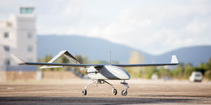
The SPYRO system consists of the air vehicle and a ground station with the software for mission planning and flight control, together with a telemetry system. The radio control transmitter can be handheld, laptop or mounted inside a control room. The SPYRO can be flown manually or autonomously by either 1 or 2 people depending on the task. All types of GCS show the downlink video in real time (with recording) plus follow the air vehicle route on a map. SPYRO has been developed for advanced missions with high demands in payload and flight stability. Its low-noise operation capability easily merges with critical operational scenarios. Compatible with our ultra- light carbon gyro-stabilized gimbal, users have full free of movement
*Prices are pre-tax. They exclude delivery charges and customs duties and do not include additional charges for installation or activation options. Prices are indicative only and may vary by country, with changes to the cost of raw materials and exchange rates.


