
- Products
- Catalogs
- News & Trends
- Exhibitions
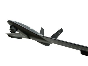
Professional UAV Besramappingagriculturalfixed-wing
Add to favorites
Compare this product
Characteristics
- Domain
- professional
- Applications
- mapping, agricultural
- Type
- fixed-wing
- Autonomy
40 min
- Maximum altitude
Max.: 3,000 m
(9842'06" )Min.: 100 m
(328'01" )
Description
In meeting with all kinds of different mission, BESRA can fly for more than 40+ minutes and is equipped with professional flight control system that can work with multiple payloads as options.
Its real-time transmission image allows you to see firsthand aerial view easily.
*Prices are pre-tax. They exclude delivery charges and customs duties and do not include additional charges for installation or activation options. Prices are indicative only and may vary by country, with changes to the cost of raw materials and exchange rates.


