- Software - Simulation
- Software
- Geolocation software
- UAV Navigation
Planning software GCS SoftwareGPSfor drones
Add to favorites
Compare this product
Characteristics
- Function
- planning, GPS
- Applications
- for drones
Description
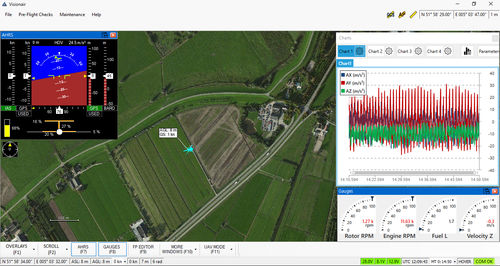
Visionair is UAV Navigation's (UAVN) standard Ground Control Station (GCS) software for planning and executing UAV missions. It is compatible with all UAVN autopilots (AP). Basic Features:Mission-oriented interfaceFully featured UAV mission planning and execution application, with GUIPlatform: PC/laptop (with keyboard + mouse)Suitable for fixed-wing, helicopter or multi-rotor UAVs and targetsMain Flight Modes: Auto, Manual, Fly-To, Hold (Hover), Safe (Return To Base)Fully Auto Take-OffFully Auto LandingCamera Control Modes: Air, Ground, Geo, Pilot View, Stow, Rate (with integrated video display)Waypoints: 100 maxRange: UnlimitedAltitude: UnlimitedFull DEM supportTarget EditorFly/No-fly ZonesFull range of configurable alarms
Related Searches
*Prices are pre-tax. They exclude delivery charges and customs duties and do not include additional charges for installation or activation options. Prices are indicative only and may vary by country, with changes to the cost of raw materials and exchange rates.

