- Drones
- Professional drone
- Professional UAV
- Swift Radioplanes

- Products
- Catalogs
- News & Trends
- Exhibitions
Professional drone Seimappingquadcopter

Add to favorites
Compare this product
fo_shop_gate_exact_title
Characteristics
- Domain
- professional
- Applications
- mapping
- Type
- quadcopter
- Maximum load
700 g
(24.7 oz)- Autonomy
70 min
Description
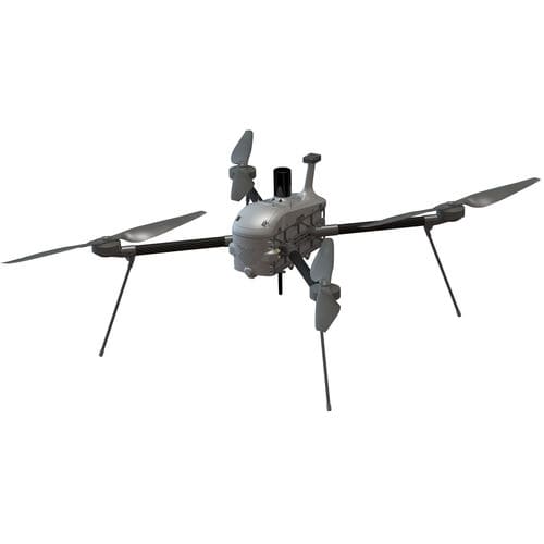
Mapping Drone For Precise Aerial Surveys
The Sei Quadcopter mapping drone is capable of performing fast aerial surveys across wide or hard-to-reach areas and producing reliable maps with unparalleled accuracy and resolution.
Sei comes equipped with a choice of Sony high resolution mapping cameras or a professional multispectral camera by Micasense. Cameras can easily be swapped in the field, making the same drone suitable for different applications.
Using the intuitive ground control software Swift GCS and the fully autonomous flying operations, surveyors can capture geo-tagged aerial images with virtually no piloting skills.
All SRP Aero’s drone image outputs can be processed by all major photogrammetry software, such as Metashape, to create highly-accurate orthomosaics and 3D models.
Long Endurance
Energy-dense lithium ion cells provide up to 70 minutes of mapping time. A hard shell enclosure protects the battery and seamlessly integrates with the airframe.
Lightweight yet Durable
The airframe uses machined aluminum to increase strength, reduce weight, and provide convenient mounting options for avionics and payloads.
Powerful Autopilot
Sei uses the world’s most trusted open source autopilot on the market. Ideal for professionals and researchers alike. Enjoy the freedom of flying without the hassle of no fly zones, altitude restrictions, or data tracking of any kind.
VIDEO
*Prices are pre-tax. They exclude delivery charges and customs duties and do not include additional charges for installation or activation options. Prices are indicative only and may vary by country, with changes to the cost of raw materials and exchange rates.
