- Drones
- Professional drone
- Professional UAV
- Shenzhen Joyton Innovation Technology Co., Ltd.

- Products
- Catalogs
- News & Trends
- Exhibitions
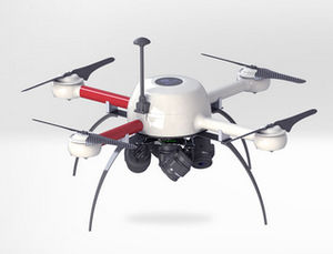
Professional UAV Titan 3D measurementquadrotor
Add to favorites
Compare this product
fo_shop_gate_exact_title
Characteristics
- Domain
- professional
- Applications
- measurement
- Type
- quadrotor
- Maximum load
22 kg
(48.5 lb)- Autonomy
85 min
Description
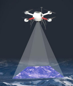
3D reality modeling & texture mapping
Capture real terrain and texture from different views,
full-autonomous matching 3D modeling with point cloud, auto extracting texture and reflecting it to the 3D model surface.
Wide applications
Equivalent measurement of length, height, angle, area, volume and so forth;
clearly see the vent, firefighting access, entrances, floor, building and other geoinformation from the 3D model generated.
Other Shenzhen Joyton Innovation Technology Co., Ltd. products
Mapping Drones
*Prices are pre-tax. They exclude delivery charges and customs duties and do not include additional charges for installation or activation options. Prices are indicative only and may vary by country, with changes to the cost of raw materials and exchange rates.


