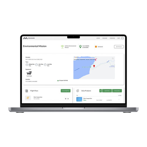
Planning software reportingfleet managementcontrol

Add to favorites
Compare this product
fo_shop_gate_exact_title
Characteristics
- Function
- planning, reporting, fleet management, control, quality, data analysis, flight planning, for maintenance
- Applications
- for aeronautics, for drones
Description
A complete solution for managing your drone program, including team and fleet management, flight planning, data validation, processing and analytics.
Centralize mission information
All your mission information in one place, from scheduling, flight logs, pilots, aircraft, flight plans, files, to incident flagging, flight playback, compliance, alerts, and image data products.
Create customized reports to download, export, and share.
Easily manage equipment, teams and data
Create equipment kits, automatically track usage and maintenance scheduling.
Manage users and set up user permissions with pre-defined roles.
Keep track of pilot certifications and proficiencies.
Centralize data storage, manage access and automate backups.
Ensure safety and regulatory compliance
Create and customize pre-flight check lists for specific operations.
Access 3rd party LAANC authorization tools and authorize DJI Geo-Unlock.
Track/store pilots’ certifications and record their credentials for each flight.
User-friendly flight planning and monitoring
Create custom flight plans or upload KML flight paths.
Generate flight plans on web, assign them to users and access them on mobile.
Capture consistent quality data with terrain following on compatible drones.
Conduct infrastructure and utility inspections using intelligent active track modes.
Check weather and pilot notifications.
Powerful in-field tools for efficiency
Eliminate data gaps and poor-quality images with Field Check in-field quality control and data validation.
Field Check automatically identifies unusable imagery and suggests a flight path for corrective recapture.
VIDEO
Catalogs
No catalogs are available for this product.
See all of senseFly‘s catalogs*Prices are pre-tax. They exclude delivery charges and customs duties and do not include additional charges for installation or activation options. Prices are indicative only and may vary by country, with changes to the cost of raw materials and exchange rates.


