- Drones
- Professional drone
- Professional UAV
- Saxon Remote Systems
Industrial drone mappingagriculturaltransport

Add to favorites
Compare this product
Characteristics
- Domain
- industrial
- Applications
- mapping, agricultural, transport
- Type
- fixed-wing
- Autonomy
75 min
Description
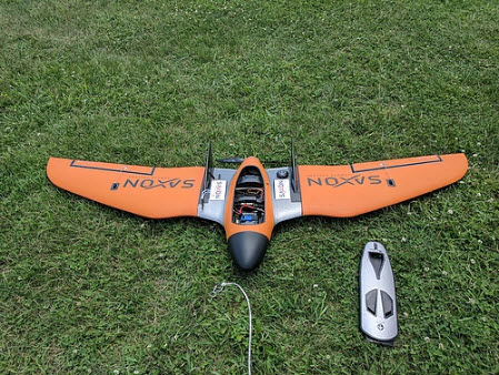
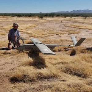
The Mapper is the essential system from Saxon to cover all your mapping and agriculture needs. This complete turnkey system is the most economical option for entering the fixed wing market or building a fleet of unmanned systems at an excellent price point. Developed specifically for agriculture and surface mapping, the Mapper system is ideally suited for agriculture crop inspections, elevation mapping, aerial survey, flood plain modeling, disaster area mapping and more.
Small Transport Case
Complete Turnkey System
Vinyl Wrapped, Carbon Fiber Reinforced EPO Foam
Sensor protection cover
Hand or Bungee launch
90 Minutes of real flight duration
Perfect for Agriculture, Survey, Elevation Mapping
Easy to use, setup in 5 minutes
VIDEO
*Prices are pre-tax. They exclude delivery charges and customs duties and do not include additional charges for installation or activation options. Prices are indicative only and may vary by country, with changes to the cost of raw materials and exchange rates.


