- Drones
- Drone equipment
- Mapping LIDAR laser
- Phoenix LiDAR Systems
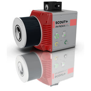
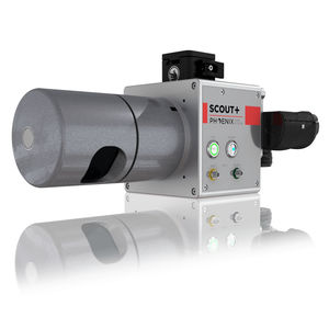
Mapping LIDAR laser SCOUT-ULTRAfor surveyingfor drones

Add to favorites
Compare this product
Characteristics
- Function
- for mapping, for surveying
- Applications
- for drones
Description
THE MOST POWERFUL MEMBER OF THE SCOUT SERIES
Lightweight and long range, the SCOUT-ULTRA enables efficient data collection for challenging areas, even at higher altitudes and speeds. An excellent option for building high-density point clouds, the SCOUT-ULTRA also features options for photogrammetry, hyperspectral, thermal imaging, and more.
Flexibility in sensing and mounting options is a key benefit of this Phoenix system.
Phoenix LiDAR Systems
Build the system you need to meet the growing demands of your clients in varying industries, from mining to agriculture and construction to forestry.
Free online tutorials available; PLUS complete Acquisition/Post-Processing/Pilot/Certification training also available (fees may apply)
Free Phoenix Software Suite w/unlimited license; plus NovAtel & Terrasolid options also available (fee may apply)
Optional Upgrades: aerial systems, dual antenna GPS, IMU upgrade options, integrated UHF radio modem, optional ground vehicle & UAV mounts/accessories, service plans and much more
Live/Remote Data Feed: View and analyze data in real time or transmit live data to remote viewers via 4G connection
Primary Applications
Agriculture
Power Utilities
Open Pit Mining
Forestry
General Mapping
Navigation System
Integrated NavBox
Constellation Support: GPS, GLONASS
Support alignment: Kinematic, Dual-Antenna
Operation Modes: Real-time, Post-processing optional
Accuracy Position: 1cm + 1ppm RMS horizontal
PP Attitude Heading RMS Error: 0.019 / 0.074°
VIDEO
Catalogs
SCOUT ULTRA
2 Pages
Phoenix UAV LiDAR Systems
20 Pages
Related Searches
- Software for the aerospace industry
- Real-time software
- Process software
- Maintenance software
- 3D software
- Online software
- Drone software
- Web-based software
- Data acquisition software
- Calculation software
- LIDAR laser
- Drone LIDAR laser
- Mapping LIDAR laser
- LIDAR software
- Surveying LIDAR laser
- 3D LIDAR laser
- Measurement LIDAR laser
*Prices are pre-tax. They exclude delivery charges and customs duties and do not include additional charges for installation or activation options. Prices are indicative only and may vary by country, with changes to the cost of raw materials and exchange rates.


