- Drones
- Drone equipment
- Mapping LIDAR laser
- Phoenix LiDAR Systems
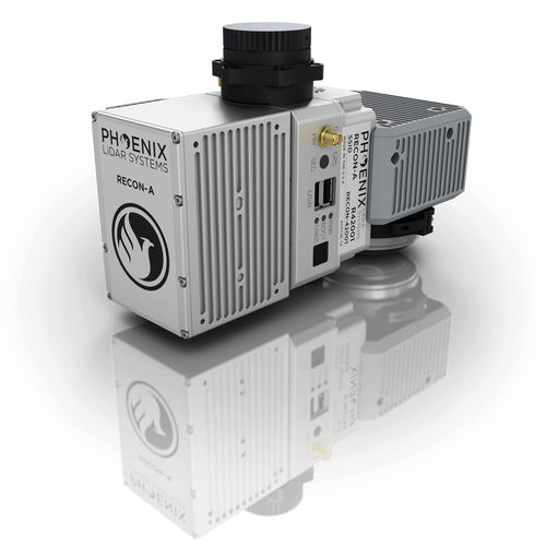
Mapping LIDAR laser RECON-Afor surveyingfor drone


Add to favorites
Compare this product
Characteristics
- Function
- for mapping, for surveying
- Applications
- for drone
Description
LIGHTEST, MOST COST EFFECTIVE LiDAR SYSTEM ON THE MARKET
The Phoenix RECON-A is the ideal solution for reconnaissance mapping missions such as vegetation encroachment on powerlines. This all-in-one payload offers ease of use and efficient data collection all at an affordable price point.
The RECON-A maximizes point cloud density by utilizing it’s multi-pattern laser to pick up even the lowest reflective points. The integrated 24 MP high resolution camera has the same FOV as the LiDAR sensor yielding maximum RGB colorization of the point cloud.
Get the solution you need to meet the growing demands of your clients in varying industries, from mining to agriculture and construction to forestry.
Survey-Grade (cm-level) accuracy with 190m laser range
Excellent reflectivity performance and optional laser pattern enables high-quality transmission line scanning
Free online tutorials available; PLUS complete Acquisition/Post-Processing/Pilot/Certification training also available (fees may apply)
PC Master Suite; plus NovAtel & Terrasolid options also available (fee may apply)
Optional Upgrades: Service plans and much more
External USB storage included; 256GB of space for capturing data all day
Primary Applications
Utility Infrastructure
Open Pit Mining
Forestry
Construction Site Monitoring
Cultural Preservation
Glacier & Snowfield Mapping
Land Erosion
VIDEO
Catalogs
RECON-A
2 Pages
Related Searches
*Prices are pre-tax. They exclude delivery charges and customs duties and do not include additional charges for installation or activation options. Prices are indicative only and may vary by country, with changes to the cost of raw materials and exchange rates.


