- Software - Simulation
- Software
- Data acquisition software
- Phoenix LiDAR Systems
Data analysis software Milldata acquisitionprocessLIDAR
Add to favorites
Compare this product
Characteristics
- Function
- data analysis, data acquisition, process, LIDAR
- Applications
- for drones
- Deployment mode
- cloud
Description
Save Time & Grow Your Business
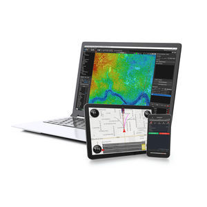
LiDARMILL, the first cloud-based LiDAR post-processing platform, automates your post-processing workflow so you can spend more time meeting your clients' needs and achieving your business goals.
Looking for a User Plan Suitable for your business? Whether you’re a surveyor, utility company, or government office, LiDARMill has packages to meet your post-processing demands.
LiDAR acquisition is only half the job. Our goal is to decrease the time and cost for users to process their raw data into a calibrated point cloud with basic ground/non-ground classification.
Meet LiDARMill, the first cloud-based LiDAR post-processing platform that enables surveying teams to take advantage of precision laser mapping without investing in expensive post-processing software and training.
Processing your LiDAR data in the cloud has never been easier. View your data, track project status, and invite clients to view point clouds – all from your LiDARMill dashboard with faster turnaround times and lower overhead costs. LiDARMill can be customized to serve any size organization, from small survey teams to government departments with heavy post-processing requirements.
LiDAR post-processing involves costly hardware, software, and training. By processing in the cloud, surveyors save money
Photogrammetry service providers exploring LiDAR as an option to expand their offerings
LiDAR surveying companies that want to invest more in hardware and save on post-processing software costs
Educational LiDAR users and researchers who need to collect and analyze LiDAR data while limiting overall program expenditures
Catalogs
No catalogs are available for this product.
See all of Phoenix LiDAR Systems‘s catalogs*Prices are pre-tax. They exclude delivery charges and customs duties and do not include additional charges for installation or activation options. Prices are indicative only and may vary by country, with changes to the cost of raw materials and exchange rates.


