- Drones
- Drone equipment
- Mapping LIDAR laser
- Phoenix LiDAR Systems
Mapping LIDAR laser RANGER-LR LITEfor surveyingfor drones

Add to favorites
Compare this product
Characteristics
- Function
- for mapping, for surveying
- Applications
- for drones
Description
FLY IT, DRIVE IT, MOUNT IT ANYWHERE. THE MOST ADAPTABLE MAPPING SYSTEM
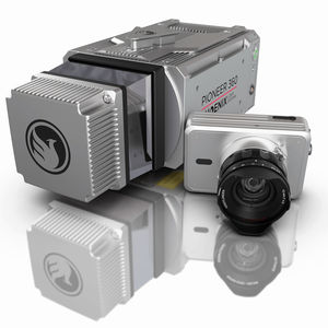
The RANGER-LR LITE is the new lighter Long Range system configuration of our RANGER Series. Designed for the most demanding mapping applications, the RANGER-LR LITE is the ultimate combination of high density, long range LiDAR with a powerful 1,550 nm laser that penetrates dense vegetation at high speeds and altitudes in large scan regions.
This system is available in UAV, vehicle, VTOL and backpack configurations, depending on your needs.
The NEW RANGER LITE includes Phoenix LiDAR’s new AIR NavBox. The newest generation, ultra-lightweight (450g) rover will help meet the rigorous demands of various industries and applications by greatly increasing flexibility in two key areas: configuration of heavier payloads for the DJI M600 series; and higher range with the highest resolution cameras on the market.The new Phoenix LiDAR AIR NavBox offers the most industry-altering capabilities in a tiny box not much bigger than a standard-size computer mouse.
Phoenix LiDAR Systems
Build the system you need to meet the growing demands of your clients in varying industries, from mining to agriculture and construction to forestry.
Ideal for configuring heavier mapping payloads on the DJI M600
Survey-Grade (cm-level) accuracy with 250m+ laser range and outstanding intensity calibration on high altitude and high speed missions
Penetrates vegetation to produce accurate results
Free Phoenix Software Suite w/unlimited license; plus NovAtel & Terrasolid options also available (fee may apply)
High accuracy due to precision Fiber Optic Gyro IMU
Optional Upgrades: aerial systems,
VIDEO
Catalogs
RANGER-LR LITE
2 Pages
Related Searches
- Software for the aerospace industry
- Real-time software
- Process software
- Maintenance software
- 3D software
- Online software
- Drone software
- Web-based software
- Data acquisition software
- Calculation software
- LIDAR laser
- Drone LIDAR laser
- Mapping LIDAR laser
- LIDAR software
- Surveying LIDAR laser
- 3D LIDAR laser
- Measurement LIDAR laser
*Prices are pre-tax. They exclude delivery charges and customs duties and do not include additional charges for installation or activation options. Prices are indicative only and may vary by country, with changes to the cost of raw materials and exchange rates.


