- Drones
- Professional drone
- Professional UAV
- microdrones
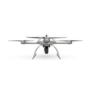
Industrial drone mdLiDAR3000 TRIPLECAM+surveillancemappinginspection
Add to favorites
Compare this product
Characteristics
- Domain
- industrial
- Applications
- surveillance, mapping, inspection
- Type
- rotary wing
- Engine type
- electric motor
- Maximum altitude
Min.: 40 m
(131'02" )Max.: 100 m
(328'01" )
Description
mdLiDAR3000 TripleCam+ is an end-to-end LiDAR solution combining a drone, a LiDAR payload, and a fully integrated software workflow. In addition this system features an Applanix APX-20 IMU for maximum efficiency.
Who Should Consider This System:
As you’ve come to expect, Microdrones provides you with the full solution: Plan, Fly, Process, Visualize. Only Bigger.
This is a serious machine for serious geomatics professionals in the construction, land development, engineering, surveying and research trades. It’s field tough and ready to work with you on the following tasks:
Digital Twin Creation and Maintenance
Corridor mapping
Mining (volume calculation)
Construction site monitoring
Environmental changes (time series)
Forestry
Contour mapping
Leveling/Excavation
Archaeology and cultural heritage
Highway construction
THE COMPLETE PACKAGE TO ADD UNMANNED AERIAL LiDAR TO YOUR GEOMATICS SERVICES
The mdLiDAR3000 TripleCam+ uses the lifting power, resilience and efficiency of the Microdrones aircraft platform to carry a perfectly integrated Riegl miniVUX‑3UAV and three 20 MP GeoCue Mapping Cameras for a total of 60MP. The result? You can quickly acquire high density and accurate LiDAR data in the field and efficiently turn it into a 3D colorized pointcloud back at the office or on your laptop.
Catalogs
No catalogs are available for this product.
See all of microdrones‘s catalogs*Prices are pre-tax. They exclude delivery charges and customs duties and do not include additional charges for installation or activation options. Prices are indicative only and may vary by country, with changes to the cost of raw materials and exchange rates.


