- Drones
- Professional drone
- Professional UAV
- microdrones
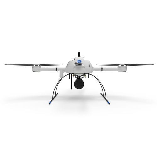
Industrial drone mdLiDAR1000UHR surveillancemappinginspection
Add to favorites
Compare this product
Characteristics
- Domain
- industrial
- Applications
- surveillance, mapping, inspection
- Type
- rotary wing
- Engine type
- electric motor
- Maximum altitude
Max.: 100 m
(328'01" )Min.: 40 m
(131'02" )
Description
mdLiDAR1000UHR means ultra-high resolution via a 32-channel LiDAR sensor, fully integrated with an improved 72.5° field of view camera. This translates to more point density, better detail, and improved deliverables. The survey equipment, LP360 Drone software, workflow, training, and support work together to make you more productive than ever.
Don’t need the full resolution of 32-channel UHR? We offer a cost competitive UHR Lite configuration, delivering 16 channels of LiDAR that can easily be upgraded later via a firmware update.
Who Should Consider This System:
Professionals responsible for geospatial data collection should consider mdLiDAR1000UHR to support the following tasks.
Digital twin creation and maintenance
Corridor mapping
Mining (volume calculation)
Construction site monitoring
Environmental changes (time series)
Forestry
Contour mapping
Planning, leveling, excavation
Archaeology and cultural heritage
Highway construction
Precision agriculture
LiDAR SURVEY EQUIPMENT + LP360 DRONE = EXTREME GEOSPATIAL PRODUCTIVITY, NOW IN ULTRA HIGH RESOLUTION
Microdrones has developed an end-to-end LiDAR solution combining a drone, a LiDAR payload, a fully integrated LiDAR processing and photogrammetry software workflow, and world class support to consistently provide quality deliverables.
mdLiDAR1000UHR and UHR Lite is a fully integrated system for producing 3D pointclouds optimized for land surveying, construction, oil & gas and mining applications.
Improved image acquisition precisely configured to match the laser scanner field of view enables compatibility with streamlined data processing modules within LP360. .
Catalogs
No catalogs are available for this product.
See all of microdrones‘s catalogs*Prices are pre-tax. They exclude delivery charges and customs duties and do not include additional charges for installation or activation options. Prices are indicative only and may vary by country, with changes to the cost of raw materials and exchange rates.


