- Software - Simulation
- Software
- LIDAR software
- KONGSBERG GEOSPATIAL
Mapping software TerraLens® 9.2LIDARfor aeronauticsreal-time
Add to favorites
Compare this product
Characteristics
- Function
- for mapping, LIDAR
- Applications
- for aeronautics
- Type
- real-time, 3D
Description
Faster 3D Terrain
TerraLens 9.2 features enhanced 3D terrain rendering for large viewports - delivering blazing 3D performance for 4K apps.
Point Cloud Support
TerraLens® 9.2 provides support for point clouds and LIDAR data - creating opportunities for immersive, highly detailed visualizations.
DPI Scaling
TerraLens 9.2 features native DPI scaling - allowing you to build crisp, responsive UIs that look equally good on mobile devices or huge 4K screens.
Reduce Risk and Deliver Performance
TerraLens® reduces the risk and complexity of application development by providing a comprehensive API that transforms low-level platform graphics into a powerful, full-featured situational display engine.
Developers can leverage a mature, purpose-built SDK to deliver the features and performance they need, instead of having to develop a display framework from scratch. The TerraLens API has been evolved and tested over decades of development, and includes hundreds of powerful features that meet the most exacting operating requirements. This allows your team to focus on your system-unique requirements, significantly reducing development time, and project risks.
The Flexibility You Need
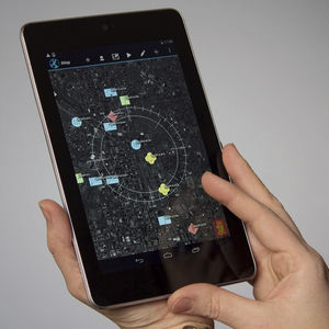
The TerraLens layered display approach allows developers to layer map data with multiple sources of geospatial data to craft complex situational displays. The system incorporates data from multiple sources, including real-time data feeds, databases, maps and images. Any number of data sources can be visually fused in the situation display, independent of their source.
Catalogs
No catalogs are available for this product.
See all of KONGSBERG GEOSPATIAL‘s catalogs*Prices are pre-tax. They exclude delivery charges and customs duties and do not include additional charges for installation or activation options. Prices are indicative only and may vary by country, with changes to the cost of raw materials and exchange rates.


