- Software - Simulation
- Software
- Mapping software
- KONGSBERG GEOSPATIAL
Mapping software TerraLens Webfor aeronauticsweb-based
Add to favorites
Compare this product
Characteristics
- Function
- for mapping
- Applications
- for aeronautics
- Deployment mode
- web-based
Description
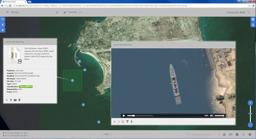
TerraLens Web is a powerful, flexible, open-standards based software foundation that allows developers to quickly add geospatial, mapping, and data-visualization capabilities to browser-based applications.
TerraLens web is more than just an application framework: it is a fully-realized foundation that includes a flexible data connector API for consuming and overlaying a variety of geospatial data sources; a fully responsive multi-touch UI that adapts to a wide array of viewports and platforms; and a sophisticated tile caching system that ensures optimal performance for web-based applications.
Catalogs
terralens_web
1 Pages
*Prices are pre-tax. They exclude delivery charges and customs duties and do not include additional charges for installation or activation options. Prices are indicative only and may vary by country, with changes to the cost of raw materials and exchange rates.


