- Software - Simulation
- Software
- Process software
- HEXAGON METROLOGY SAS
Management software GeoMedia qualityanalysisautomation

Add to favorites
Compare this product
Characteristics
- Function
- management, quality, analysis, automation, process
- Applications
- for aeronautics
- Type
- real-time
Description
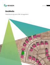
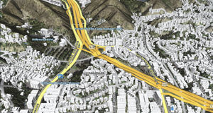
Maps present data visually, allowing you to visualize location and gain other information from your data. Making the information-gathering process easier—making a good map—requires powerful analytical tools and clear symbolization. Whether updating land and tax records, analyzing traffic flow and accidents, or determining the best locations for evacuation centers, GeoMedia combines tabular and geographic data to produce actionable information.
GeoMedia is a powerful, flexible GIS management platform that lets you aggregate data from a variety of sources and analyze them in unison to extract clear, actionable information. It provides simultaneous access to geospatial data in almost any form and displays it in a single unified map view for efficient processing, analysis, presentation, and sharing. GeoMedia's functionality makes it ideal for extracting information from an array of dynamically changing data to support informed, smarter decision-making.
Adopt next-level automation for your utilities network
Utility organizations use GeoMedia to better plan, operate, and manage assets using geospatial intelligence and smart workflows.
Get real-time data for smart cities
GeoMedia tools and analytics help city leaders increase the quality of urban services, engage with the community, and decrease overall costs and resource consumption.
Generate actionable information for public safety
Public safety agencies use GeoMedia to analyze live queries for fast results, determine event hotspots for mitigation, and run historical queries for future insight.
VIDEO
Catalogs
GeoMedia
12 Pages
Related Searches
- Software for the aerospace industry
- Real-time software
- Process software
- Maintenance software
- 3D software
- Online software
- 2D software
- Measurement software
- Web-based software
- Automated software
- Server software
- Machining software
- Calculation software
- Data collection software
- Inspection software
- Web browser software
- CFD software
*Prices are pre-tax. They exclude delivery charges and customs duties and do not include additional charges for installation or activation options. Prices are indicative only and may vary by country, with changes to the cost of raw materials and exchange rates.


