- Software - Simulation
- Software
- Navigation software
- Geodetics, Inc.
Navigation software VYOfor dronesreal-time
Add to favorites
Compare this product
fo_shop_gate_exact_title
Characteristics
- Function
- navigation
- Applications
- for drones
- Type
- real-time
Description
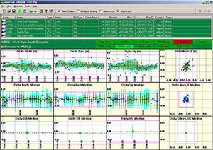
Geodetics’ VYO Windows application provides a convenient interface to visualize time, position, attitude and related information (TSPI) streaming from a single or multiple Geodetics navigation systems. VYO can also be used to display recorded data.The Geo-iNAV® and other Geodetics products can accept RTCM 3 as input. This is an industry standard protocol providing GPS reference data for differential GPS processing. Use of this reference data with Geodetics products can yield up to centimeter-level accuracy in real-time. VYO can be used to forward this RTCM 3 reference data to the Geo-iNAV® (s) from which it is receiving TSPI data.
Catalogs
No catalogs are available for this product.
See all of Geodetics, Inc.‘s catalogs*Prices are pre-tax. They exclude delivery charges and customs duties and do not include additional charges for installation or activation options. Prices are indicative only and may vary by country, with changes to the cost of raw materials and exchange rates.


