Management software INSPECTOR 4.0reportingmeasurementdata analysis
Add to favorites
Compare this product
Characteristics
- Function
- management, reporting, measurement, data analysis, navigation, process, for maintenance, LIDAR
- Applications
- for drones
- Type
- 3D
- Deployment mode
- cloud
Description
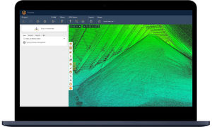
Visualize, localize, and document your inspections with Inspector 4.0. An easy-to-use software solution developed to allow asset operators to make fast, data-driven decisions.
Without the right management solution, acting on raw drone data can be a real challenge, leading to approximative reporting, uncertain decisions, and eventually resulting in sub-optimal maintenance operations. Inspector 4.0 gives you a precise view of what’s happening inside your assets so your team can act quickly in just the right place.
One seamless workflow
From data capture to decision making, Inspector 4.0 and Elios 3 work hand-in-hand to provide operational continuity, boosting your efficiency throughout the inspection process.
Accurate data
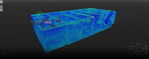
Thanks to Elios 3’s LiDAR sensor, inspection data is now reported on a high density point cloud of your asset, offering a whole new level of data accuracy and reliability.
Instant localization
Whether captured in flight or tagged during data analysis, points of interest show instantly on the 3D model of your asset—with no additional processing.
The mapping feature of Inspector 4.0 relies on different things depending on the drone you use. For Elios 3 users, the mapping and localization is performed on the drone using our homemade SLAM engine FlyAware™. For Elios 2 users, Inspector's mapping feature relies on Visual-Inertial Odometry (VIO). VIO estimates the position and velocity of Elios 2 by using only the input of the main camera plus the Inertial Measurement Unit (IMU) attached to it.
Photogrammetric 3D models are meant to be extremely accurate and to combine visual features (texture) with 3D point clouds or 3D meshes.
Catalogs
No catalogs are available for this product.
See all of FLYABILITY‘s catalogs*Prices are pre-tax. They exclude delivery charges and customs duties and do not include additional charges for installation or activation options. Prices are indicative only and may vary by country, with changes to the cost of raw materials and exchange rates.


