- Software - Simulation
- Software
- Aeronautic software
- ENVIRONMENTAL SYSTEMS RESEARCH INSTITUTE, INC.
Data management software ArcGIS Bathymetryanalysisfor aeronautics
Add to favorites
Compare this product
fo_shop_gate_exact_title
Characteristics
- Function
- data management, analysis
- Applications
- for aeronautics
Description
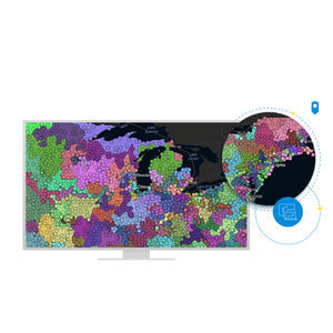
ArcGIS Bathymetry GIS enables bathymetric data management by providing an easy-to-use, scalable solution that leverages the power of ArcGIS. Its ability to support a broad range of data types, combined with the visualization and analysis tools in ArcGIS, increases the value of your bathymetry data. Bathymetry offers intuitive user interfaces and geoprocessing tools that are suitable for novice and advanced GIS users. Customized metadata streamlines data access and enables quick generation of custom bathymetric surfaces through targeted data selection and prioritization. Information can be extracted on the fly, eliminating unnecessary duplication.
Bathymetry GIS
Unlock the power of a GIS-based system and take advantage of its many capabilities, including analysis, visualization, and serving data for charting and other needs.
Streamline bathymetric data management
No need to learn complex data management. Bathymetric datasets are left in their original storage location(s) and are managed from one central point, eliminating the need for data duplication or increased data storage.
Customize metadata
ArcGIS Bathymetry offers tools that allow you to define custom metadata associated with your data. This streamlines access to data and enables quick filtering and sorting of archives to generate models of the seafloor.
Manage
Unique and intuitive user interfaces and geoprocessing tools address the bathymetric data management needs of beginners and advanced GIS users.
Visualize
ArcGIS Bathymetry allows you to visualize multiresolution and multitemporal data simultaneously for applications such as change detection analysis.
Analyze
Catalogs
No catalogs are available for this product.
See all of ENVIRONMENTAL SYSTEMS RESEARCH INSTITUTE, INC.‘s catalogsOther ENVIRONMENTAL SYSTEMS RESEARCH INSTITUTE, INC. products
Products
Related Searches
- Esri aeronautic software
- Real-time software
- Airport software
- Process software
- Maintenance software
- 3D software
- Online software
- Tracking software
- 2D software
- Web-based software
- Mapping software
- Server software
- Collaborative software
- Image analysis software
- GPS software
- Flight analysis software
- Interoperability software
- LIDAR software
- Administration software
- Advertising software
*Prices are pre-tax. They exclude delivery charges and customs duties and do not include additional charges for installation or activation options. Prices are indicative only and may vary by country, with changes to the cost of raw materials and exchange rates.


