- Drones
- Drone equipment
- Surveying LIDAR laser
- Draganfly Drones
Surveying LIDAR laser for drones
Add to favorites
Compare this product
fo_shop_gate_exact_title
Characteristics
- Function
- for surveying
- Applications
- for drones
Description
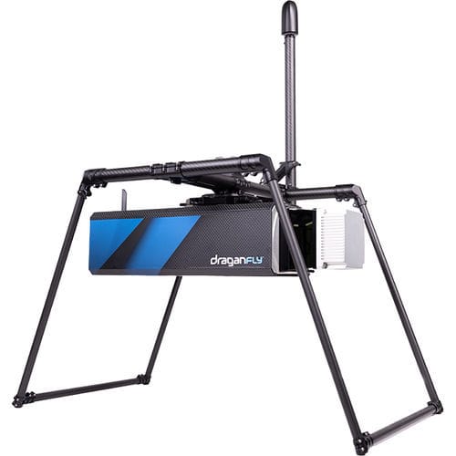
The best-in-class long-range laser scanning system producing survey-grade point cloud data.
Draganfly’s Long Range LiDAR (DLR- LiDAR) system provides accurate distance measurements and improved resolution over conventional photogrammetry methods. The cutting-edge sensor technology can be mounted on UAV, airplanes, and helicopters for those professionals requiring precision imagery.
Ultimate
LiDAR System
Draganfly Long Range LiDAR integrates the most advanced sensors from a world leader with 40 years of sensor experience, Teledyne (LiDAR sensor), and trusted industry expert, Applanix (IMU + GNSS).
Teledyne’s components are used in commercial and military aerospace design, while Applanix (a Trimble company) remain the industry standard in survey components worldwide.
Best-in-class Laser Scanner
The Teledyne sensor produces survey-grade point clouds with a 360-degree laser scanner. Up to 750-meter/2460 feet range (50kHz). Class-leading point cloud fidelity with a low beam divergence allows for a safe scanning distance from the ground in even the most hazardous terrain.
Four laser returns capture more ground points and enable high-accuracy bare earth models under the thickest vegetation. Draganfly Long Range LiDAR produces 0.5cm point cloud precision with 2cm global accuracy resulting in high-resolution data at 2 million points per second.
Application Versatility
The Draganfly LiDAR provides versatility in mounting options. It can be mounted on UAVs, airplanes, helicopters or used as a mobile scanning solution when mounted on a vehicle or backpack providing accurate mapping data for all industries.
Catalogs
No catalogs are available for this product.
See all of Draganfly Drones‘s catalogsRelated Searches
- Software for the aerospace industry
- 3D software
- Drone camera system
- Navigation software
- Tracking software
- 2D software
- Aeronautic camera
- Drone software
- Flight planning software
- Infrared camera
- LIDAR laser
- Data collection software
- Drone LIDAR laser
- Radio remote control
- Drone radio remote control
- Surveying LIDAR laser
*Prices are pre-tax. They exclude delivery charges and customs duties and do not include additional charges for installation or activation options. Prices are indicative only and may vary by country, with changes to the cost of raw materials and exchange rates.


