Mapping software AIP-GIS Charting®for aeronautics
Add to favorites
Compare this product
fo_shop_gate_exact_title
Characteristics
- Function
- for mapping
- Applications
- for aeronautics
Description
AIP-GIS Charting®
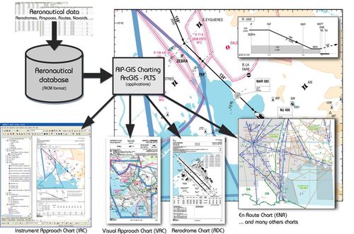
AIP-GIS Charting® is a mapping solution that can be used to edit, update and publish maps, in a georeferenced environment, to the civil and military AIP. This solution is based on Esri, AIP-GIS Charting® and the OACI regulations and can be used to produce maps via a direct connection to aeronautical databases. It also takes into consideration the temporality of the associated data (AIRAC cycle and others).
Catalogs
GéoTITAN®
2 Pages
*Prices are pre-tax. They exclude delivery charges and customs duties and do not include additional charges for installation or activation options. Prices are indicative only and may vary by country, with changes to the cost of raw materials and exchange rates.


