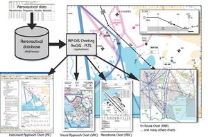
Analysis software OESfor mappingfor airport
Add to favorites
Compare this product
fo_shop_gate_exact_title
Characteristics
- Function
- analysis, for mapping
- Applications
- for airport
Description
Obstacle Evaluation Solution (OES)
OES provides a web service with the national Aeronautical Information Services which is in charge of the management, collection, organisation and distribution of aeronautical information.
OES is used to evaluate the potential impact of infrastructure modifications on aerial navigation and provides the necessary data to properly use the associated information (OLS and EZS), in accordance with Appendix 15 of the OACI and in accordance with local regulations (such as Eurocontrol in Europe).
Catalogs
OES
2 Pages
*Prices are pre-tax. They exclude delivery charges and customs duties and do not include additional charges for installation or activation options. Prices are indicative only and may vary by country, with changes to the cost of raw materials and exchange rates.


