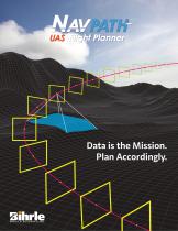
Flight planning software NavPathfor aeronautics3D
Add to favorites
Compare this product
fo_shop_gate_exact_title
Characteristics
- Function
- flight planning
- Applications
- for aeronautics
- Type
- 3D
Description
NavPath
Advanced Flight Planning Software for UAS
NavPath is a modern UAS flight planning tool that combines an immersive 3D environment, ease of use, and a powerful feature set to enable UAS operators to focus on the data collection task rather than the flight plan.
The Power Of NavPath
NavPath is a UAS-agnostic flight planning tool that combines advanced features with a flexible and intuitive user interface. NavPath supports a growing number of UAS platforms, provides the importing of GIS reference data, offers flexible and powerful flight profile definition, supports cylindrical, polygon and tunnel geo-fencing, and provides the ability to preview the flight before exporting the flight plan file for direct import to the UAS platform. NavPath enables you to generate the most efficient and optimized flight plan for your UAS application!
Catalogs
NavPath
2 Pages
*Prices are pre-tax. They exclude delivery charges and customs duties and do not include additional charges for installation or activation options. Prices are indicative only and may vary by country, with changes to the cost of raw materials and exchange rates.


