- Software - Simulation
- Software
- Image analysis software
- Airelectronics
Quality software U-Mosaicimage analysisfor drones
Add to favorites
Compare this product
fo_shop_gate_exact_title
Characteristics
- Function
- quality, image analysis
- Applications
- for drones
Description
U-Mosaic software is designed to improve the value of images taken during a UAV flight.
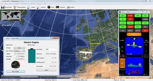
Using the data provided by U-Pilot and U-See software, U-Mosaic projects the images on the ground, generating a preliminary vision to help the user to analyze the data.
This pre-visualization of the pictures gives the user the opportunity of detecting errors and misalignments between the generated data and the retrieved images. This error detection along with the correction tools provided by U-Mosaic improves notably the quality of the final results when working with terrain modelling software.
U-Mosaic is designed to work with several third party software such as Pix4D or Agisoft among others, becoming an essential tool when working with aerial imagery.
HighLights
Georeferred projection of the taken pictures.
Simple interface, no configuration required.
Export to several formats; Pix4D, Agisoft, ...
Compatible with U-See software and Airelectronics systems.
Catalogs
No catalogs are available for this product.
See all of Airelectronics‘s catalogs*Prices are pre-tax. They exclude delivery charges and customs duties and do not include additional charges for installation or activation options. Prices are indicative only and may vary by country, with changes to the cost of raw materials and exchange rates.


