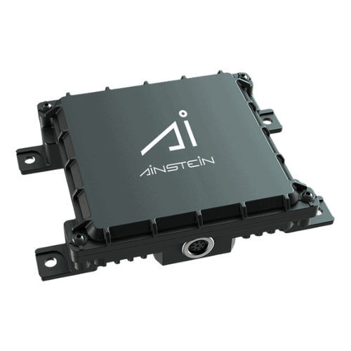
Altimeter without display LR-D1 feet or metersfor aircraftfor drones

Add to favorites
Compare this product
Characteristics
- Display
- without display
- Measurement unit
- feet or meters
- Applications
- for aircraft, for drones
- Altitude range
Max.: 1,640 in
Min.: 0 in
Description
Ainstein UAV Long Range Radar Altimeter LR-D1 is a low-cost, high-performance mmWave Radar altimeter designed for advanced unmanned aerial vehicles (UAVs), manned helicopters, and other GA aircraft
Field of View (A/E): ~90° x 30°
Operating Frequency: 24GHz
Detection Angle Range: Azimuth 43°,Elevation 30°
Size: <112mm*102.5mm*29mm
Weight: 300g
Over oceans and lakes
Up to 1,640' Range Measurement
Over mountains
Smooth readout
Over forest canopies
Built for tough Environments
Over sand
Cross-validation monitoring
Over snow
customizable
Highly Accurate
Have you tried to land your plane in stormy weather? Do you fly over lakes or oceans often? Have you ever flown into an airport in the mountains? Do you have a permit to fly in cloudy conditions, but want added safety assurance?
Ainstein’s UAV Long Range Radar Altimeter LR-D1 provides accurate altitude measurement in these diverse operating environments, giving you the confidence you need to fly by knowing exactly how much space you have to maneuver — especially during landing.
The Ainstein UAV Long Range Radar Altimeter LR-D1 provides advanced cross-validation technology that continuously monitors incoming data, assuring the measured altitude is accurate, even in low-visibility conditions.
LR-D1 also measures vertical speed of your plane, giving you added data points for safe take-off and landing.
VIDEO
Catalogs
LR-D1
7 Pages
*Prices are pre-tax. They exclude delivery charges and customs duties and do not include additional charges for installation or activation options. Prices are indicative only and may vary by country, with changes to the cost of raw materials and exchange rates.


