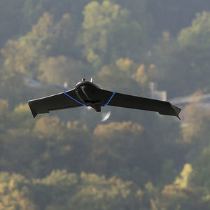
Agricultural drone eBee Agprofessionalmappingfixed-wing
Add to favorites
Compare this product
Characteristics
- Domain
- professional
- Applications
- mapping, agricultural
- Type
- fixed-wing
- Engine type
- electric motor
- Maximum load
10 kg
(22 lb)- Autonomy
55 min
Description
Map your crops easily with the fixed-wing drone for agriculture
Affordable agriculture drone with dual RGB and multispectral camera that unlocks a flight time of up to 55 minutes and covers 160 ha / 395 ac in a single flight.
With available RTK, the fixed-wing achieves down to 2.5 cm / 1 in GSD while collecting data critical to monitoring field health and helping catch early indicators of diseases.
RGB + multispectral camera
The Duet M is an innovative dual-purpose RGB and 4-band multispectral camera for field mapping.
It creates geo-accurate multispectral maps – NDRE, NDVI and more – and digital surface models (DSM) with data invisible to the naked eye.
2.5 cm / 1 in absolute accuracy
With its available RTK, the agriculture drone can achieve absolute accuracy down to 2.5 cm / 1 in with its RGB camera.
eBee Ag’s light weight allows operators to fly safely within more regulatory frameworks worldwide and increase mapping capabilities with BVLOS flights and Operations Over People.
Equipped with its standard battery, eBee Ag can fly up to 45 minutes. An available endurance battery increases the flight time up to 55 minutes — allowing the drone to cover 160 hectares / 395 acres in a single flight.
RTK available
eBee Ag features available Real-Time Kinematic (RTK) functionality for greater mapping precision. With RTK enabled, the agriculture drone can achieve absolute accuracy down to 2.5 cm / 1 in.
Shock absorbent design
eBee Ag underbelly is made of reinforced polypropylene woven mesh. This shock-absorbent construction designed by our R&D team is rugged and durable.
Catalogs
No catalogs are available for this product.
See all of AgEagle‘s catalogs*Prices are pre-tax. They exclude delivery charges and customs duties and do not include additional charges for installation or activation options. Prices are indicative only and may vary by country, with changes to the cost of raw materials and exchange rates.


