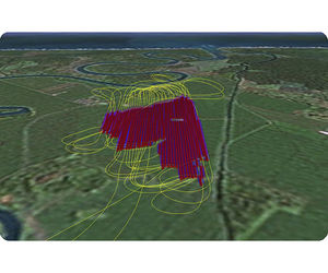
SprayView allows you to create powerful flight reports. With both SprayView and NavViewW, you can create a detailed flight data report with spray data. SprayViewW allows you to create additional reports which can be customized with the ...
AG-NAV
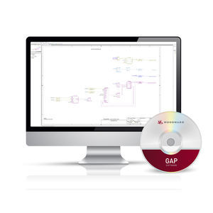
... during development, testing, and field applications. For ease of learning and use, the GAP software diagram entry screen has the look and feel of several software simulator tools familiar to many ...

ground-based instrument approach system that provides precision lateral and vertical guidance to an aircraft approaching and landing on a runway Description/Properties system AMS sends a request and waits for data monitoring is performed ...

... RIEGL's mobile and airborne laser scanning systems. Both, mobile and airborne systems comprise at least one laser scanner, a position and attitude measurement system, and an operator's work station. Many systems further ...
LATITUDE’S SOFTWARE EXPERTS ARE CAPABLE OF DEVELOPING SOFTWARE TO SUPPORT A WIDE RANGE OF APPLICATIONS: Firmware development for a broad spectrum of embedded systems used in the unmanned vehicle arena. Autopilot ...
Flight planning software for eBee drones. This easy-to-use desktop ground station allows you to intuitively plan your missions, interact with your drones during the flight and prepare the data for post-processing. Easy ...

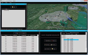
... other ground crew to chart real-time flight paths for an unlimited number of aircraft. Our leading SkyWeb flight following software is a mature system in its fourth generation and is trusted by over 6500 users around ...
... III hardware applications providing the avionic supplier enable installation of 3rd party software on the aircraft’s Class III EFB units. Type A, B and C software solutions are supported.
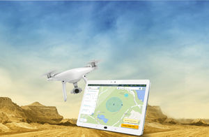
FLIGHT PLANNING DRONE APP FOR HIGH RESOLUTION PHOTOSHOOTING Designed for land surveying, construction and infrastructure mapping, DatuFly™ drone app optimizes flight and image capturing per job type. The image taking plan is executed ...
... application, specifically designed for managing existing air navigation obstacles and analyzing local data of airport interest. ALBATROS is an expansion of the GIS (Geographic Information System) software, ...
... interface to visualize time, position, attitude and related information (TSPI) streaming from a single or multiple Geodetics navigation systems. VYO can also be used to display recorded data.The Geo-iNAV® and other Geodetics ...

... dedicated solution. This is also a requirement for the implementation of SWIM, virtual centres and remote towers. Air Navigation Service Providers (ANSPs) integrate multiple technologies (e.g. MPLS, microwave, VSAT) ...
Systems Interface Limited
The Robota GCS (Ground Control System) is the intuitive interface that commands our vehicles and Goose autopilot. Flight planning can be performed by simply clicking waypoints on a map, or by dropping search patterns over the area ...
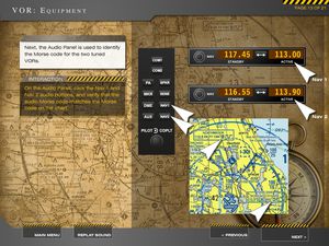
... interactive training modules in 5 hours teach traditional VOR navigation through advanced GPS and FMS advanced avionics. What kind of pilot are you? An advanced avionics type? A traditional navigation ...
AVIATION TUTORIALS COMPANY, LLC
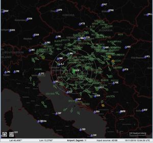
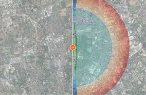
The AVIONIX tsd (Traffic Situation Display) allows air traffic controllers to monitor the current traffic situation in the terminal area (TMA). tsd provides a map background of the TMA including all necessary information. In an additional ...
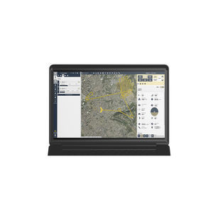
NavPath Advanced Flight Planning Software for UAS NavPath is a modern UAS flight planning tool that combines an immersive 3D environment, ease of use, and a powerful feature set to enable UAS operators to focus on the ...

... -ES” Industrial consortium. NEXT has been involved in many phases of the system lifecycle in charge of software verification and validation, software components integration, database and information management ...
NEXT INGEGNERIA DEI SISTEMI SPA

MAX Load is the a complete low cost graphical aircraft Weight & Balance system designed for Low Cost Airlines. Integrates with any DCS system and offers multiple options for load planning and trim sheet management.

... of voice messages with actual information for pilots. Automatic broadcasting of voice messages in the frame of the Air Navigation Services as a support equipment. Fully digital system capable to cooperate with both ...

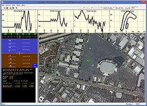
... acquisition of high fidelity test data and achieve dramatic improvements in overall test speeds. AeroPro test management software features a tightly integrated control and data acquisition user interface and unmatched ...
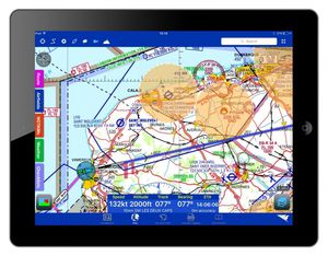
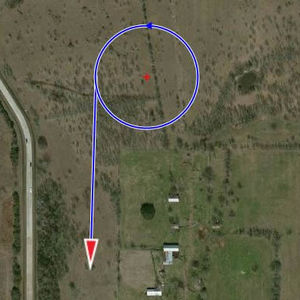
... and distance to the boundary. The clear five-minute line helps plan where you’ll be heading and the relative position read out makes position reports a doddle. Bring traffic awareness to your flying ...

... Airside Driving Permits Grass Cutting Policy Loss of High Voltage Power NOTAM and SNOWTAM Fire Department Daily Report Navigation equipment and visual signs/marking check Aircraft Deicing protocol WHAT MAKES ...
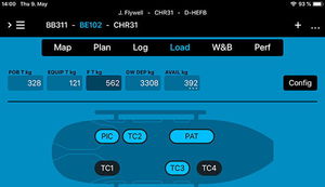
Set up seats and stretchers, add your rescue, medical or any other gear you use and create equipment configurations for any helicopter and mission you fly. A crew database supports quick selection of flight crews as well as medical, ...
AheadX Space is the new generation ground control software for SAGI/LEOguidance navigation control system which is developed by AheadX with new designed interface, graphical visual display for key information ...
AheadX Tech (Beijing) Co. Ltd.

A forecast tool to help you plan your maintenance and ground time A complete solution designed for aircraft operators and maintenance shops. TracingNav© is a management tool to optimise aircraft fleet availability and foresee ground ...
the best suppliers
Please specify:
Help us improve:
remaining