- Drones >
- Drone equipment >
- Measurement LIDAR laser
Measurement LIDAR lasers
{{product.productLabel}} {{product.model}}
{{#if product.featureValues}}{{product.productPrice.formattedPrice}} {{#if product.productPrice.priceType === "PRICE_RANGE" }} - {{product.productPrice.formattedPriceMax}} {{/if}}
{{#each product.specData:i}}
{{name}}: {{value}}
{{#i!=(product.specData.length-1)}}
{{/end}}
{{/each}}
{{{product.idpText}}}

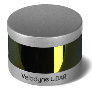
Velodyne LiDAR's ULTRA Puck™ VLP-32C is the newest long-range LiDAR sensor in its product portfolio that combines best-in-class performance with a small form factor. A high-resolution LiDAR ...
Velodyne

Expanding on Velodyne LiDAR's groundbreaking VLP-16 Puck, a 16-channel, real-time 3D LiDAR sensor that weighs just 830 grams, Puck Hi-Res is used in applications that require greater resolution in the ...
Velodyne

... made to Puck LITE™ as it retains its patented 360° surround view to capture real-time 3D LiDAR data that includes distance and calibrated reflectivity measurements.
Velodyne

... advanced product in Velodyne's 3D LiDAR product range. Vastly more cost-effective than similarly priced sensors, and developed with mass production in mind, it retains the key features of Velodyne's breakthroughs in LiDAR: ...
Velodyne

... EXCEED THE DEMANDS OF THE MOST CHALLENGING, REAL-WORLD INDUSTRIAL APPLICATIONSThe HDL-32E LiDAR sensor is small, lightweight, ruggedly built and features up to 32 lasers across a 40° vertical field of ...
Velodyne

... mobile data collection and mapping applications. The HDL-64E's innovative laser array enables navigation and mapping systems to observe more of their environment than any other LiDAR sensor.
Velodyne

... system provides dual purpose topographic and bathymetric measurements for full scene mapping of shoreline systems. Utilizing a visible green spectrum laser with an elliptical scan pattern and measurement ...
Your suggestions for improvement:
the best suppliers
Subscribe to our newsletter
Receive updates on this section every two weeks.
Please refer to our Privacy Policy for details on how AeroExpo processes your personal data.
- Brand list
- Manufacturer account
- Buyer account
- Our services
- Newsletter subscription
- About VirtualExpo Group


Please specify:
Help us improve:
remaining