
... the next level with the capabilities of Agisoft Photoscan Pro. Contact us to schedule a consultation to discuss how this software can help you model and break down data.

... training modules in 5 hours teach runway incursion prevention, airport ground operations, and ground-navigation safety, with a 3D taxi simulator. Don't become a victim or a cause of runway incursions! ...
AVIATION TUTORIALS COMPANY, LLC
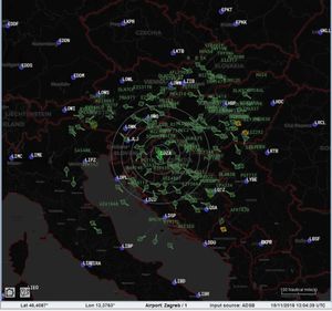
... Mode-A/C only, Mode-S, ADS-B) together with information about the target in configurable text form. In addition to the 2D display, a 3D view is featured to show the current traffic ...
AVIONIX SOFTWARE S.L.
... training, and letting you spend time on mission rehearsal, not building databases. Additionally, with its 60HZ output, the 3D scenes that GenesisIG creates are pinpoint sharp. “We chose GenesisIG in ...
ANTYCIP SIMULATION

The Reverse Engineering Module is used to analyze in detail an existing aircraft to figure out among other its aerodynamic efficiency (Maximum lift coefficient, maximum lift increment, friction coefficient, zero lift drag coefficient…) ...
OPTIMAL AIRCRAFT DESIGN
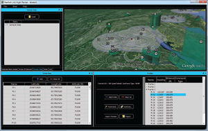
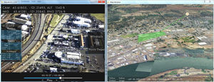
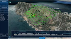
NavPath Advanced Flight Planning Software for UAS NavPath is a modern UAS flight planning tool that combines an immersive 3D environment, ease of use, and a powerful feature set to enable ...
... Universal Control Software (UCS) is a central point where you can manage all your unmanned vehicles. It does not matter whether you have one drone or a fleet Tor Universal Control Software will suite ...
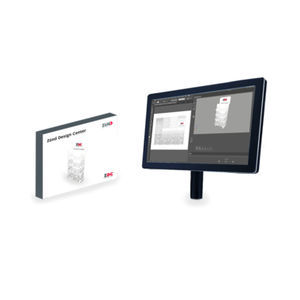
... text, and other design elements. With 3D preview, you can check your design any time. 3D PDF files exported from ZDC are ideal for presentations or proposals. In ...
In order to take full advantage of any gimbal’s capabilities, a feature rich user interface is required. As opposed to alternative gimbal interfaces that were “designed by engineers for engineers” featuring pages of data, Trillium’s ...
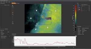
... like creation of protocols, 3D models and highly detailed analysis of radiometric videos, including editing sequences and the option to store individual images, etc.When connecting a Workswell WIC thermal ...
Workswell s.r.o.

... minimize the risk of design inconsistencies or unforeseen behavior in the integration phase. Our systems architecture design software Pacelab SysArc supports investigations at the aircraft level with a fully-fledged ...
PACE GmbH
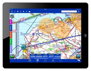
Planning Take the time and hassle out of flight planning with RunwayHD’s comprehensive range of planning features. Use the route builder to find your start and end points, then effortlessly drag and drop new waypoints around any airspace. Handy ...
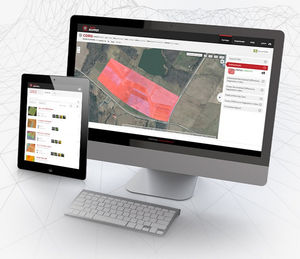
... cloud-based mapping and analysis softwareScout easily and get insights from your drone data with PrecisionMapper. Create 2D and 3D maps and analyze your orthomosaics to get valuable insights ...

... constantly evolving. What today is up to date, is soon outdated and needs to be customized. Even new hardware often requires software adjustments to ensure optimal functionality. The flexible team of developers at benntec ...
... and optimum results. During flight mode, QBase 3D provides accurate information on aircraft and mission status to ensure flight safety and mission success. After mission completion, QBase 3D ...
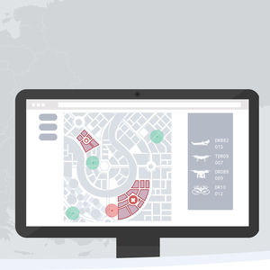
Airspace Security Management Combine UTM and drone detection (C-UAS) capabilities to detect, identify and differentiate all air traffic within airports and critical infrastructures. Drone traffic detection Ground-based radar systems ...

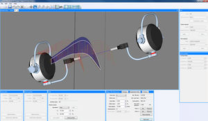
UNDERSTANDING BEHAVIOUR See your aircraft in flight with J2 Virtual. This plug-in provides a unique 3-D viewing capability, which shows the aircraft and its characteristics during any manoeuvres. Not ...
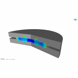
Aerospace forged components producers face the challenges of designing, testing and delivering their products on-time and on-budget together with producing parts complying with the in-use properties requirements.Since the beginning, TRANSVALOR ...

... generated by analyses. Results are sorted based on a choice of references for the Z Axis (RPM, time and levels) and represented in 3D or profile views (Bode plots, cross-phase tracking, …). The section ...
TecView™ 3D is a NDT software featuring basic and advanced contour following capabilities. This software is designed to perform inspection of curved structure while keeping ...

... life-cycle. Data4Flight® helps you to generate ARINC coding by importing flight procedures and allowing you to view them, in 2D or 3D, using Google Earth®. DATA4Flight® also offers ...
... and analyse any significant deviations. Disseminate the mission performance via reports, graphs, data streams, videos and 3D fly through animations.

... systems like hexapods Pre-configured models connect directly to Aerotech's A3200 motion controller Import custom objects as 3D mesh files Supports collision detection between all elements in the environment Control ...

... Tools Simple Yet Powerful Component of OMEGA Software That Converts Vector Graphics Into Gerber Router/Cutter Tool Paths ARTPath™ routing and engraving software is a simple yet powerful component of ...

TerraLens Core (Formerly InterMAPhics), is the high-performance geospatial visualization and mapping software development kit at the heart of the TerraLens geospatial platform. TerraLens Core has been optimized for spatial ...
KONGSBERG GEOSPATIAL
the best suppliers
Please specify:
Help us improve:
remaining